Project Planning
How to Identify Property Lines Before Clearing
Before clearing anywhere near a boundary, you need to know where that boundary actually is — and on overgrown rural property, that's often easier said than done. The good news is there are several ways to identify your lines yourself before deciding whether you also need a professional survey. This guide walks through them.
Start With Your Deed and Plat
Your deed and any recorded plat (survey map) are the written description of your boundaries — the distances, bearings, and reference points that define the parcel. They're the starting point for understanding the shape and size of what you own and roughly where the lines run. On their own they can be hard to translate to the ground, but they tell you what you're looking for and often reference the corner markers.
Find the Corner Pins
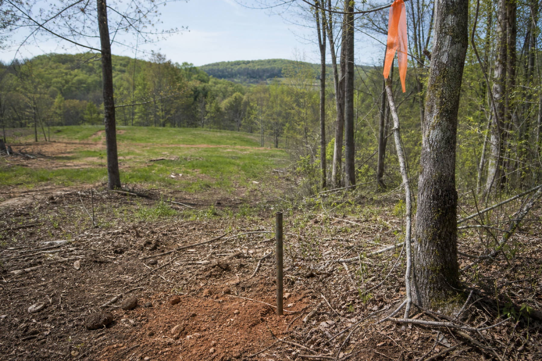
- Most surveyed parcels have iron pins or rebar at the corners — the physical anchors of your boundary.
- They're often buried in leaves, soil, or overgrowth; a metal detector helps locate them.
- The plat's measurements from a known corner help you search the right spot.
- Found pins let you string a line between corners to see where the boundary actually runs.
Use County Records and Mapping Tools
County property records and GIS mapping (many Tennessee counties have online parcel viewers) show your parcel boundaries overlaid on aerial imagery — useful for orientation and a rough sense of the lines. Consumer property-line apps do the same on your phone. These are genuinely helpful for planning and for knowing roughly where you are, but treat them as approximate: their accuracy is limited, and they're not a substitute for pins and a survey when you're clearing right up to a line.
Know When to Call a Surveyor
Self-identification has limits. If you can't find the corner pins, the deed description is ambiguous, the parcel is irregular, or you're clearing close to a line where a mistake would matter, that's when a professional survey earns its cost — it puts the boundary on the ground with authority. Our guide on whether to get a survey helps you weigh it. The rule of thumb: the closer you're clearing to a boundary and the less certain you are, the more a survey is worth it.
Helpful Guides
This guide is general information for property owners and does not replace an on-site evaluation. Upper Cumberland Land Clearing is an independent referral service; project scope, methods, equipment, pricing and scheduling are determined by the contractor who reviews your property.
Project Planning Questions
Start with your deed and recorded plat for the boundary description, locate the corner pins on the ground (often buried — a metal detector helps), and use county GIS/parcel maps or property-line apps for orientation. For clearing right up to a line, confirm with a professional survey.
They're useful for a rough idea and planning, but their accuracy is limited — good for orientation, not for deciding exactly where to run a machine near a boundary. Where precision matters, rely on corner pins and, if needed, a survey rather than an app.
Use your plat's measurements to search the likely spots, and a metal detector to find the iron pins or rebar, which are often buried in soil, leaves, or overgrowth. Once you locate two corners, you can string a line between them to see the boundary.
When you can't find the pins, the deed is ambiguous, the parcel is irregular, or you're clearing close enough to a line that an error would matter. The nearer the work is to an uncertain boundary, the more a professional survey is worth it.
Ready to Turn Overgrown Land Into Usable Property?
Share your contact details and you’ll be contacted to discuss where the property is, how much land is involved and what needs to be cleared.